The Warnemünde Planetary Path

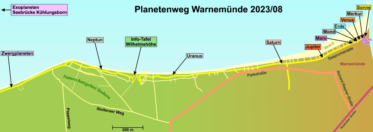
The Warnemünde Planetary Path is a model of the planets and their orbits in our Solar System. The 4.5 km path leads from the model of the sun located at the lighthouse in Warnemünde along the waterfront promenade and the Warnemünde coastal footpath to the outermost planet of the Solar System, Neptune, visualising distances in space. Furthermore, there are information boards for dwarf planets (with Pluto as a representative) and exoplanets. The path uses a scale of 1 m walk on Earth = 1 million km in space and presents surprising findings about the celestial bodies of our Solar System from current research.
The Warnemünde Planetary Path was created in 1979 by chief engineer Alfred Hellwig. Since then, the project has been designed by the Astronomischer Verein Rostock e.V., which revised it once in 2005. Today’s path was created in cooperation with the Institute of Physics at the University of Rostock after a young group of PhD students won €10,000 in the Science Year 2023 to redesign the educational trail.
An overview map created by the Astronomischer Verein Rostock e.V. helps with orientation on the Planetary Path:

